TY-FINS-40S
Fiber Optic Inertial Products

Product Introduction
TY-FINS-40S integrated navigation system is based on a three-axis integrated fiber optic gyroscope, quartz flexure accelerometer, and high-precision satellite receiver. It adopts advanced integrated navigation algorithms to achieve high-precision measurement of the attitude, velocity, and position of moving carriers. It adapts to complex electromagnetic environments and harsh mechanical environments and can be applied to navigation and attitude measurement of various aircraft, vehicles, and ships.
Product Composition
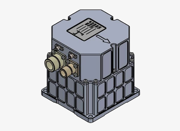
The TY-FINS-40S integrated navigation system mainly consists of a three-axis fiber optic gyroscope, three-axis quartz flexure accelerometers, vibration damping system, high-precision satellite receiver, high-precision signal conversion circuits, navigation computer, power conversion circuits, interface circuits, and navigation software.
Product Functions
· Equipped with the function of initial alignment under static and dynamic conditions;
· Equipped with inertial navigation function;
· Equipped with the function of providing high-precision satellite-based augmentation system (SBAS) differential GNSS information;
· Equipped with INS/GNSS integrated navigation function;
· Equipped with communication with user terminals function;
· Equipped with the function of correcting system installation errors by binding external parameters.
Technical Indicators
|
Category |
Technical Indicators |
Achieved Indicators |
|
Measurement Range |
Heading Angle Range |
0°~360° |
|
Pitch Angle Range |
±90° |
|
|
Roll Angle Range |
±180° |
|
|
Angular Velocity Measurement Range |
±500°/s |
|
|
Acceleration Measurement Range |
±20g |
|
|
Alignment Time |
When satellite navigation orientation is valid |
≤1min |
|
When satellite navigation orientation is invalid |
≤5min |
|
|
Self-Alignment Accuracy |
Heading Angle Alignment Accuracy |
When satellite navigation orientation is invalid: Static Base: ≤0.6°×sec(Lat) (1σ, Lat is local latitude) Dynamic Base: ≤0.05° (1σ, maneuvering conditions) |
|
When satellite navigation orientation is valid: ≤0.1° (1σ, baseline length ≥2m) |
||
|
Attitude Angle Alignment Accuracy |
≤0.02° (1σ) |
|
|
Pure Inertial Navigation Accuracy |
Position Accuracy |
≤10nm (RMS, 1h) |
|
≤0.8nm (RMS, 10min) |
||
|
Velocity Accuracy |
≤9m/s (RMS, 1h) |
|
|
≤0.8m/s (RMS, 10min) |
||
|
Heading Angle Holding Accuracy |
≤0.2° (1σ, 1h) |
|
|
Attitude Angle Holding Accuracy |
≤0.15° (1σ, 1h) |
|
|
Integrated Navigation Accuracy (PDOP≤4) |
Single Point Positioning Accuracy |
Horizontal ≤2m, Vertical ≤5m(RMS) |
|
RTK-assisted Positioning Accuracy |
Horizontal ≤(2+1ppm×D)cm (RMS) Vertical ≤(5+1ppm×D)cm (RMS) D is the baseline length in km |
|
|
Velocity Accuracy |
≤ 0.03 m/s (RMS) |
|
|
Heading Angle accuracy |
≤ 0.1° (1σ, baseline length ≥ 2m) |
|
|
Attitude Angle Accuracy |
≤0.02° (1σ) |
|
|
Gyroscope Performance |
Bias Stability |
≤0.1°/h (1σ, 10s smoothing) |
|
Bias Stability |
≤0.05°/h (1σ, 100s smoothing) |
|
|
Bias Repeatability |
≤0.1°/h (1σ) |
|
|
Random Walk |
≤0.01°/h1/2 |
|
|
Accelerometer Performance |
Bias Stability |
≤0.15mg (1σ, 10s smoothing) |
|
Bias Stability |
≤0.05mg (1σ, 100s smoothing) |
|
|
Bias Repeatability |
≤0.05mg (1σ) |
|
|
Other Indicators |
Power Supply |
DC 12V~36V |
|
Product Power Consumption |
Steady-State Power Consumption ≤17W, Transient Power Consumption ≤35W |
|
|
Main Unit Weight |
≤1.8kg |
|
|
External Dimensions |
112mm×112mm×120mm |
|
|
Installation Dimensions |
100mm×100mm (4×φ6.5mm) |
|
|
Ingress Protection |
IP66 |


版权所有:Copyright © 2025 suncitygroup太阳新城(中国)集团官方网站 All Rights Reserved 备案号:渝ICP备17008919号-1 -技术支持:网润软件


